
Going to Bed with a Mild Tropical Storm, Waking Up to a Category 5 Monster
On the evening of September 21, 2026, residents along Mexico’s Pacific coast checked their weather apps before going to bed. The forecasts indicated that the nearby weather system, named Polo, was merely a weak tropical storm.
By the following morning, people awoke to howling gale-force winds and torrential rain. Sucking up intense heat over warm ocean waters, the storm had jumped multiple categories overnight to become a monster Category 5 hurricane. Communities along the coast were left with only a few frantic hours to prepare or evacuate.
Meteorologists classify this phenomenon as rapid intensification—defined as an increase in sustained winds of at least 35 mph (roughly 55 km/h) within a 24-hour window. In 2018, Hurricane Michael underwent a similar sudden explosion right before making landfall in the Florida Panhandle, leaving catastrophic destruction in its wake. Today’s numerical models can reliably calculate where a hurricane will travel tomorrow, yet they repeatedly stumble when predicting how lethal it will be upon arrival.
In recent years, leading meteorological agencies and technology giants have deployed AI-based weather forecasting systems. Many anticipated that massive training datasets paired with unprecedented compute power would finally conquer the hurricane intensity puzzle. The physical reality of the atmosphere, however, has delivered a sobering counterpoint.
Global Scale vs. Local Fury: Why Predicting Intensity Is a Tough Nut to Crack
Over the past few years, the leap forward made by artificial intelligence in numerical weather prediction has been undeniable. Deep learning architectures trained on decades of global reanalysis data can simulate future planetary temperature, barometric pressure, and wind fields over several days in mere seconds. At the planetary scale, AI models already stand shoulder-to-shoulder with the finest physics-based supercomputer simulations.
Yet the moment a model zooms in from planetary dynamics to localized severe storms, the difficulty spikes exponentially. Global forecasting tracks planetary-scale atmospheric flow—much like watching the broad main current of a mighty river, where the general trajectory is readily apparent. Hurricane intensity, by contrast, is a regional phenomenon. It is the mathematical equivalent of predicting how a single chaotic burst of spray will churn within a turbulent eddy.
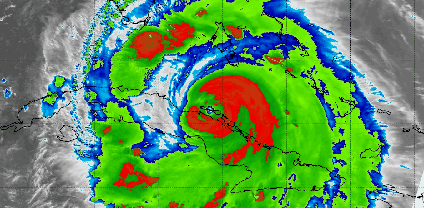 Figure: Satellite infrared imagery capturing complex cloud-top structures surrounding a hurricane eyewall. Source: The Conversation / NASA
Neural networks excel at recognizing macro-scale patterns, but they often falter in the face of localized, non-linear extremes. A hurricane’s track is steered largely by expansive background air currents, allowing AI to project its trajectory with remarkable precision. But hurricane intensity is governed by micro-scale thermodynamic exchanges within a core spanning just tens of kilometers. That discrepancy strikes directly at the blind spot of deep learning models.
The Open Ocean Data Void: Even Advanced AI Cannot See Beneath the Cloud Tops
The first fundamental roadblock confronting AI intensity forecasts is an acute data deficit. Across landmasses and along inhabited shorelines, meteorologists operate dense networks of automated ground stations and moored ocean buoys. Ground crews can also deploy Doppler radar systems to measure precipitation velocity and eyewall structures in real time. These instruments provide richly detailed, three-dimensional atmospheric observations.
Crucially, however, the rapid intensification phase almost always unfolds over the open ocean, hundreds of kilometers from the nearest coastline. In these vast oceanic expanses, in-situ observation instruments are virtually non-existent. Weather satellites provide cloud-top temperature readings and rough estimates of precipitation, but orbital sensors cannot penetrate the dense, towering eyewall clouds to directly measure true boundary-layer wind speeds near the ocean surface.
When physical measurements fall short, atmospheric scientists typically turn to synthetic datasets generated by physical simulations. The datasets used to train meteorological AI models incorporate vast volumes of simulated data produced by numerical physics engines. Yet all numerical simulations rely on approximations and parameterizations. When an AI model is trained on synthetic data that inherently contains physical biases, the neural network naturally internalizes those shortcomings.
Chaos at the Core: Why Physics Imposes a Hard Ceiling on Precision
If the bottleneck were merely a shortage of observational data, deploying more sensors and dropsonde probes would eventually solve the dilemma. But research led by Chanh Kieu, an associate professor of atmospheric science at Indiana University, reveals that the core predictive failure stems from the intrinsic physics of the atmosphere itself.
When a tropical cyclone draws thermal energy from the sea surface, its strength accelerates toward a theoretical threshold known in meteorology as maximum potential intensity (the theoretical wind speed limit calculated from sea surface temperatures and vertical wind shear). The warmer the underlying ocean, the higher this ceiling rises. Yet as a storm nears this thermodynamic ceiling, internal feedback mechanisms trigger minute, uncontrollable disturbances.
The findings from Kieu’s team are unequivocal: as storm intensity approaches this ceiling, it enters a chaotic intensity attractor—a phase space where the storm’s intensity fluctuates in an essentially non-deterministic fashion. Even if future observation systems could measure every cubic meter of air across the storm every second, microscopic fluctuations in storm intensity would remain unpredictable. It is akin to rolling a marble into a spinning bowl: while the exact geometry of the bowl can be measured with laser precision, the exact point of impact between the marble and the rim cannot be computed.
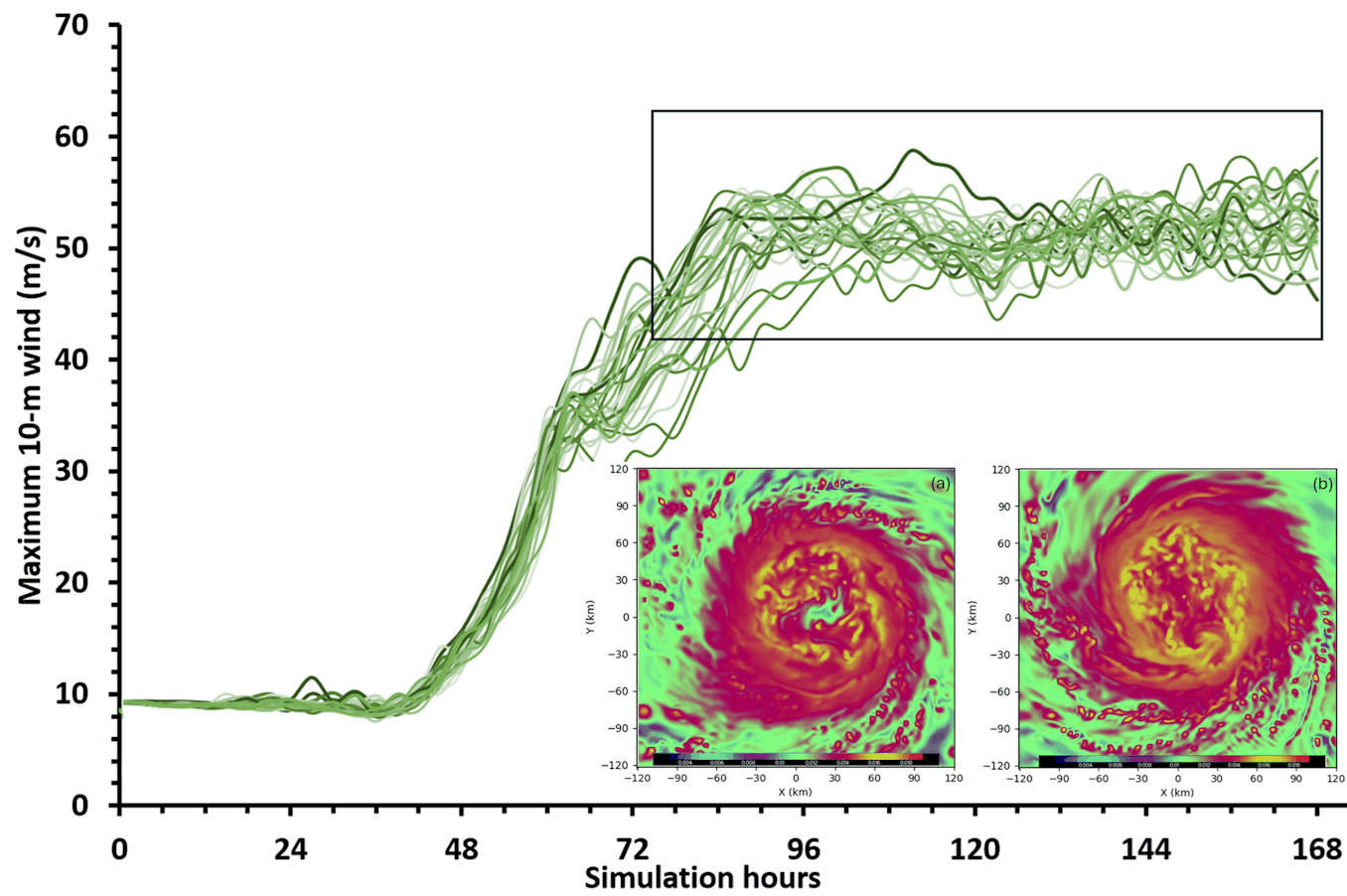 Figure: Computer simulations demonstrate that as forecast lead times extend, two Category 5 storms starting from nearly identical initial conditions diverge dramatically in their intensity trajectories. Source: The Conversation
This intrinsic chaos poses an existential dilemma for deep learning training objectives. During optimization, machine learning models seek to minimize global forecast error across the entire training dataset. Consequently, neural networks naturally gravitate toward outputting the most probable average trajectory. Rapid hurricane intensification, however, represents a rare and violent outlier. The harder an AI strives to minimize global average error, the more aggressively it smooths out the very intensity spikes that matter most.
Moving Beyond Single Numbers: Forecasting Probabilistic Ensembles
The chaotic ceiling established by atmospheric physics is unambiguous. Trying to squeeze a single, pinpoint wind speed figure out of brute-force computational power violates fundamental physical laws. Microscopic fluctuations in the boundary layer set a natural boundary on deterministic precision.
Confronted with this boundary, the paradigm of meteorological forecasting is undergoing a fundamental shift. Rather than demanding a single deterministic wind speed number, forecasters are transitioning toward predicting ranges of potential intensity and comprehensive probability distributions.
As Professor Chanh Kieu notes, understanding this chaotic mechanism is essential for defining the limits of predictability. Shifting warning systems from single-number predictions to probabilistic ensembles represents a critical milestone. Disaster relief agencies and coastal communities can only prepare for worst-case scenarios when they are given the complete spectrum of risk.
Reference Links:
- Report in The Conversation