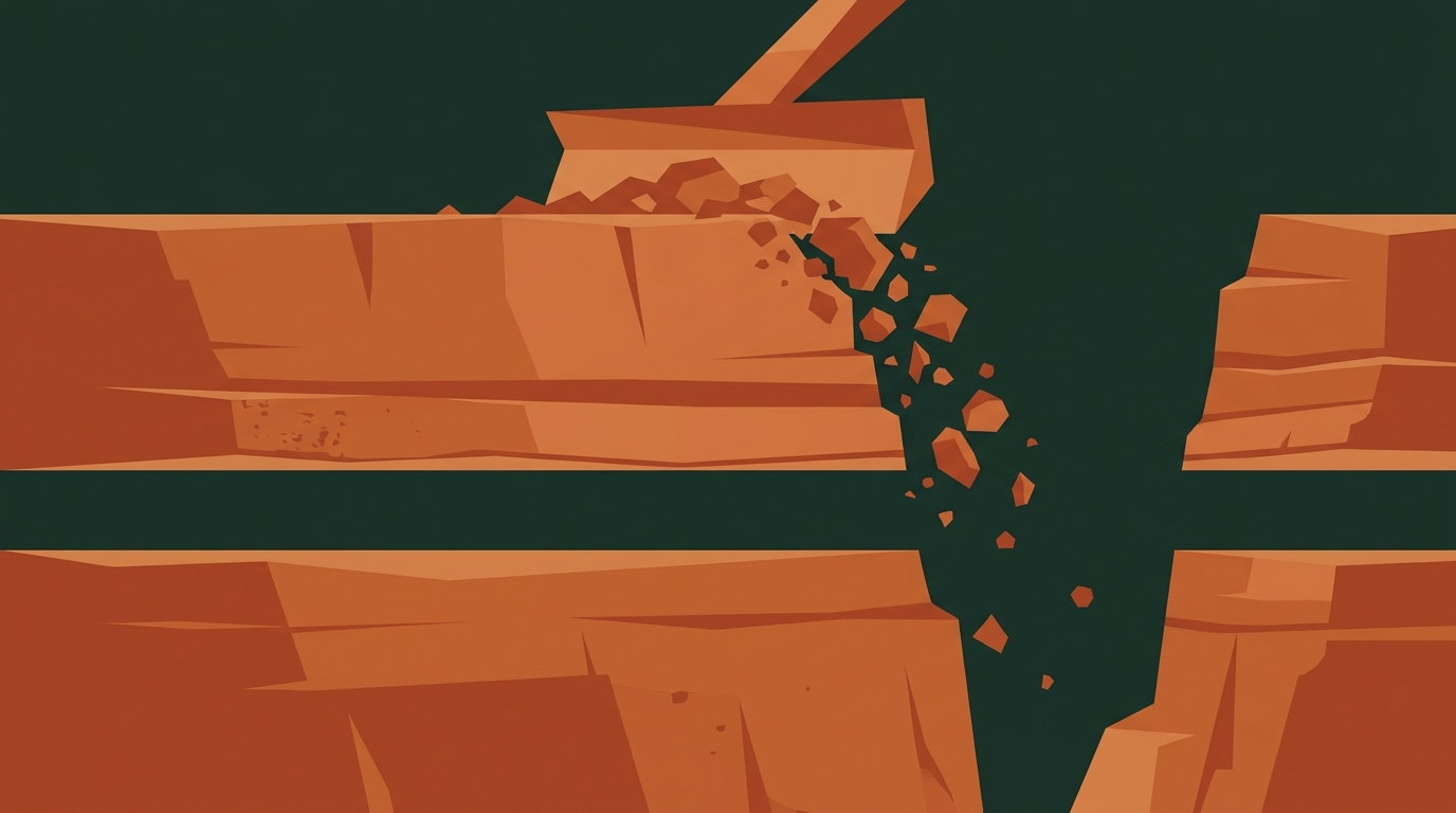
Standing along the rim of the Grand Canyon and peering hundreds of meters down into the chasm, visitors are invariably awed by the sheer spectacle of red, ochre, and chocolate-brown rock layers. The canyon walls rise like a colossal geological mille-feuille, neatly stacked layer upon layer. Yet beneath these magnificent horizontal bands lies geology’s most famous unsolved mystery. If you place a fingertip directly on one specific seam in the rock, the sandstone and shale above it date to roughly 520 million years ago. But the dark, crystalline metamorphic schist lying flush directly beneath is nearly 1.8 billion years old.
The two rock formations sit tightly fused together, yet between them, nearly a billion years of Earth’s chronological record has vanished into thin air. That missing span represents close to a quarter of our planet’s entire 4.6-billion-year history. From the emergence of complex trilobites in ancient shallow seas back to the world of primitive single-celled life, an entire volume of the geological record was cleanly excised from the planetary archive.
In geological science, this planetary hiatus is known as the Great Unconformity—a profound boundary where strata from vastly disparate geological eras lie in direct contact, marking an epic gap in the rock record. Now, a study published in Geology by an international research team led by Thomas Gernon at the University of Southampton offers a compelling physical explanation: hundreds of millions of years ago, an immense cliff system reared across the ancient North American continent, working in tandem with glacial networks to scour a billion years of crust completely away.
Layered Like a Cake, Yet a Billion Years Are Missing
Rock strata serve as Earth’s natural self-recording chronicle. Mud, silt, and sand settle across seabeds and lake basins, compacting and crystallizing under intense pressure layer upon layer over deep time. Under standard stratigraphy, the deeper a stratum lies, the older its origin. Because the Grand Canyon plunges 1.6 kilometers deep into the Colorado Plateau, its walls should theoretically offer an unbroken record spanning roughly two billion years of planetary environmental change.
Instead, directly beneath the 520-million-year-old Tapeats Sandstone, an expected billion-year sequence of strata simply does not exist. It is akin to opening a 200-page family biography, finishing page 50, and finding that page 51 jumps without warning to page 150—with every intermediate record of marriages, migrations, and upheavals torn away without a trace.
Past hypotheses attempted to account for the gap through varying mechanisms. Some researchers argued that the land surface was too arid or elevated to accumulate sediments during that era. Others placed the blame on “Snowball Earth”—the Neoproterozoic period when global ice sheets expanded from the poles toward the equator—suggesting that advancing glaciers planed away existing strata like a colossal wood planer. However, uniform glacial scouring alone struggled to explain why this denudation was so extensive, yet varied so dramatically in magnitude across the southwestern United States.
Supercontinent Rifting Tore Open a Two-Kilometer Cliff
Gernon and his colleagues turned their attention back 800 million years to the breakup of the supercontinent Rodinia. At that time, virtually all of Earth’s landmasses were joined into a single giant landmass. As plumes of mantle heat pooled deep underground, the superplate experienced immense extensional stresses and began pulling apart.
When ancient North America (known as Laurentia) rifted away from the rest of Rodinia, the continental margins did not separate cleanly or smoothly. Instead, intense thermal uplift and tectonic stretching ruptured the western margin of Laurentia, creating a colossal landform known as a “great escarpment.”
Geophysical simulations indicate that this ancient escarpment stretched for thousands of kilometers, extending from present-day Alaska all the way south to Arizona, with sheer vertical drops of 1 to 2 kilometers. Analogous tectonic landscapes remain visible on Earth today—notably the Drakensberg mountain range within South Africa’s Great Escarpment and the steep coastal ranges of southeastern Brazil—both of which formed along continental margins as earlier supercontinents fragmented.
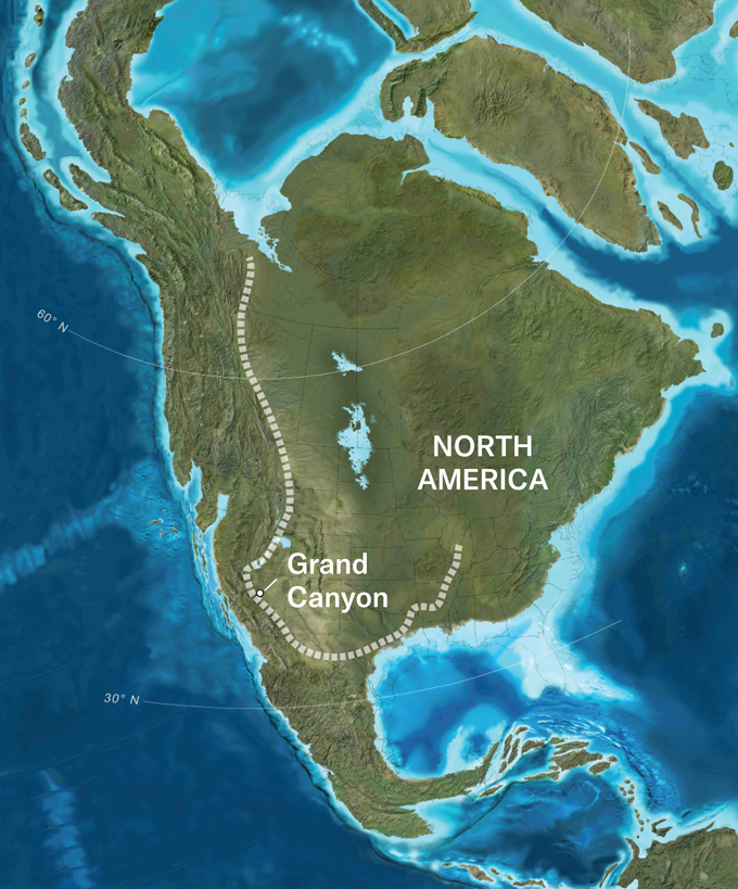 Figure: The ancient mega-escarpment (dashed line) extended along the western margin of Laurentia, stretching from Alaska to Arizona. Source: T.M. Gernon et al/Geology, 2026; Ron Blakey/Deep Time Maps, via Science News
Glacial Mills Scoured the Escarpment, Stripping Up to 8 Kilometers of Rock
The formation of such a colossal cliff fundamentally altered the pace and power of surface erosion. On low-lying, flat plains, rain and seasonal runoff weather underlying rock at a modest pace. But once terrain is thrust upward by 1,000 to 2,000 meters, rainfall coalesces into ferocious high-gradient river systems. Driven by steep gravitational drops, torrents carrying sand, gravel, and boulders aggressively undercut the cliff base, forcing the escarpment into rapid inland retreat.
Critically, the development of this mountainous rim coincided with the frigid onset of Snowball Earth. The high-altitude cliff crests became natural catchments for heavy snow, where massive alpine and ice-sheet glaciers accumulated into ultra-efficient erosion factories.
As glaciers cascaded down the kilometer-high cliffs, they functioned like giant serrated planers. The combined force of surging meltwater and grinding ice aggressively scoured the underlying crystalline basement. Numerical models indicate that between 5 and 8 kilometers (and in some places up to 10 kilometers) of solid rock were planed off Laurentia’s western margin—the equivalent of grinding an entire mountain range the height of the Himalayas down to its roots.
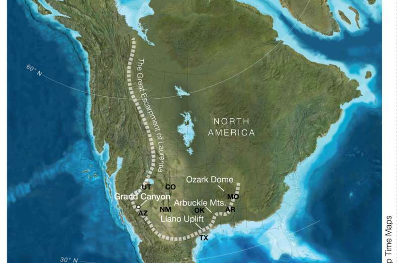 Figure: Landscape reconstruction of the Great Escarpment along ancient North America (Laurentia). Source: Prof Tom Gernon, University of Southampton, via Phys.org
Plate Reconstructions Pinpoint the Grand Canyon’s Ancient Front Line
To validate their hypothesis, the research team coupled global plate-tectonic reconstructions with landscape evolution models, recreating Laurentia’s ancient paleotopography. By simulating thermal uplift, gravitational flank collapse, and river-glacial incision, the modeled results matched field stratigraphic observations across North America with remarkable precision.
The reconstructions confirmed that the Grand Canyon region sat directly along the inland retreat trajectory of the great escarpment, positioning it squarely within the bullseye of the most intense denudation zone. The Grand Canyon is thus an exceptional geological window into this continent-scale denudation, preserving direct evidence of the deep crustal stripping that took place.
Alan Collins, a professor of geology at the University of Adelaide who was not involved in the study, praised the findings, noting that a rift-induced great escarpment provides an intuitive and mechanically robust physical mechanism for the missing strata.
An Ancient Scar Reveals How Continents Reorganize
The modern Grand Canyon, carved by the waters of the Colorado River, is only five to six million years old. Yet the rocks exposed along its canyon walls date back to the foundations of the continent. The missing billion years is not a passive void in history, but an enduring scar carved by the violent tectonic rearrangement of Earth’s landmasses.
Geologists are now looking to extend this model to similar ancient unconformities in Australia and Africa. Across the globe, profound gaps in the rock record likely originated from the rifting of ancient supercontinents, where mega-escarpments and climate extremes joined forces to reshape the crust.
The Grand Canyon’s missing billion years maps directly to this continent-spanning mega-cliff. Torn open by the breakup of Rodinia and planed flat by Snowball Earth glaciers, an entire chapter of Earth’s geological chronicle was scoured away. What appears as a blank space in the strata is, in truth, an indelible testament to the colossal forces that tear continents apart and remake our planet.
References:
- Science News
- Phys.org / University of Southampton Press Release