
A newly built bike lane submitted to Google and Apple Maps sits indefinitely in review, only to be rejected without explanation. On OpenStreetMap, a local cyclist takes a few laps with a GPS tracker, traces the coordinates, and within hours, the path appears across dozens of downstream navigation apps. A step-by-step tutorial demonstrating how to perform this kind of edit in just fifteen minutes surged to the top of Hacker News with 590 points—becoming the highest-ranked post of the day.
What a 590-Point Tutorial Reveals About Modern Mapping
When a practical guide on adding web links to a digital map captures 590 points on Hacker News, it signals something deeper than curiosity about cartography. The tutorial, published by high5apps under the title Make Your First Edit to OpenStreetMap in the Next 15 Minutes, has a goal that borders on mundane: finding a local business on OpenStreetMap (OSM) and adding its official website URL. That a workflow devoid of groundbreaking technology could ignite such intense enthusiasm in a hardcore engineering forum reveals years of pent-up user frustration. In today’s heavily capitalized proprietary map ecosystems, the channels available to ordinary citizens for correcting street-level data have been virtually shut down.
Most software engineers take for granted that geospatial accuracy is the exclusive domain of multi-billion-dollar corporate fleets. They assume high-precision mapping requires fleets of LiDAR-equipped vehicles and sprawling offshore annotation factories. Yet this tutorial offers a refreshingly accessible counter-narrative. The workflow spans seven straightforward steps: create an OpenStreetMap account, download the roughly 365 MB Java-based JOSM desktop editor, and select a neighborhood bounding box to fetch raw vector data. Next, apply a search filter to pinpoint places with a name and an address or shop tag, but lacking a website or contact:website tag. Finally, install the dedicated WebsiteWizard plugin to streamline the review and update process.
A workflow that looks like a system administration manual from twenty years ago struck a profound chord with developers. Outside the opaque black boxes of corporate tech, engineers crave a sense of agency. Once an editor patches missing metadata for a city block, that data does not vanish into a proprietary walled garden behind an expensive API paywall—it flows directly into a public data commons accessible to anyone on Earth.
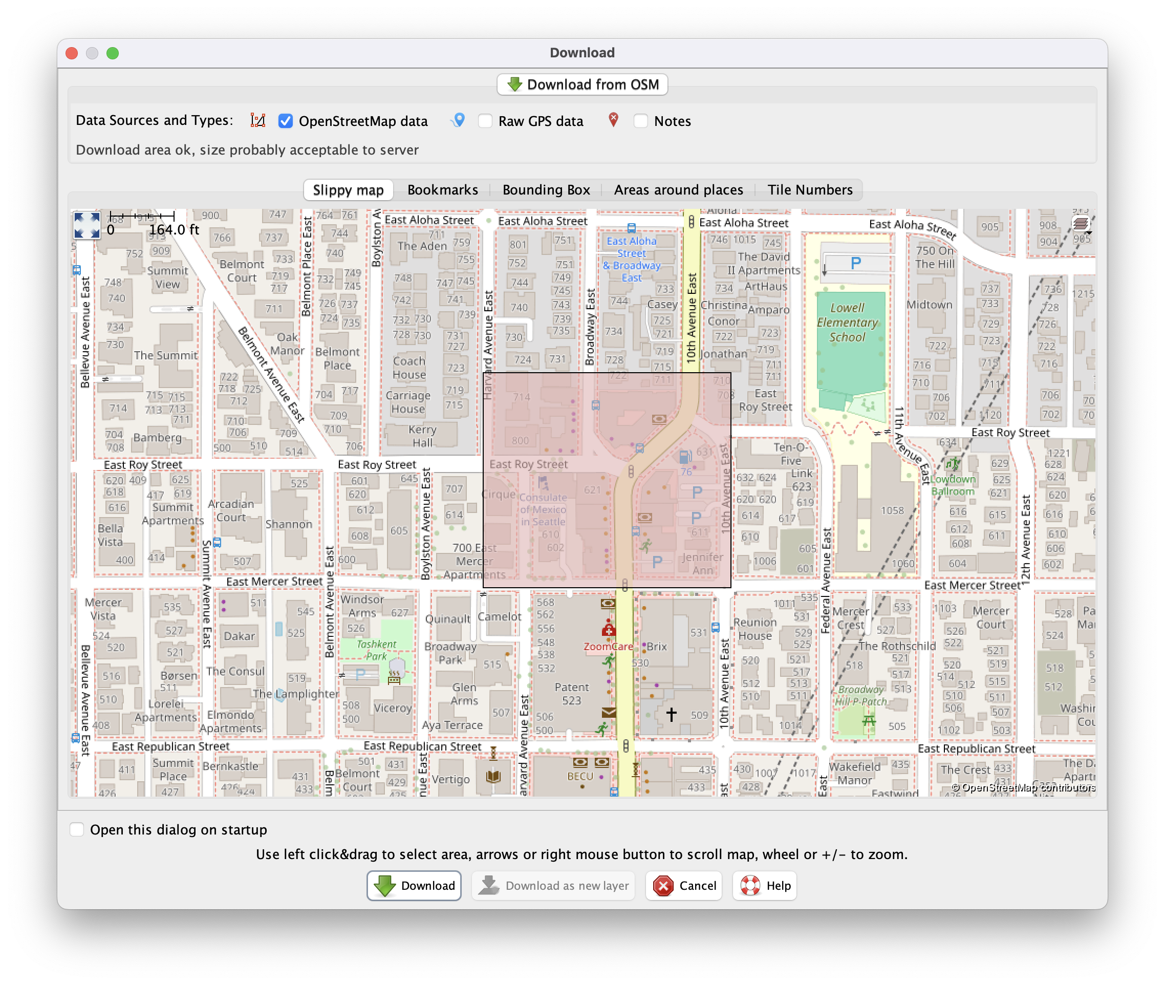 Figure: JOSM download panel, selecting an area of interest. Source: high5apps tutorial
Seattle Neighborhood Test Exposes Ground-Level Blind Spots
The tutorial’s author demonstrated the practical impact of this workflow in a real-world test run, adding 66 missing website tags across Seattle’s Wallingford neighborhood in a single session. That staggering deficit came from just one ordinary urban district. Extrapolating across the United States alone, the author estimates that more than one million brick-and-mortar businesses in OSM lack an official web link. This massive gap highlights a fundamental flaw in centralized data collection: street-level camera cars and automated satellite imagery can never inspect what lies tucked inside physical doorways.
As the author points out, adding a website tag yields returns far beyond a single string of text. In an age of widespread automated scrapers and scrapers, an accurate homepage URL acts as a master key. Once a website is tagged, secondary metadata—phone numbers, opening hours, contact emails, and social profiles—can be derived programmatically. A simple URL string of a few dozen characters becomes the most cost-effective structural anchor for unlocking rich contextual data.
The tutorial also emphasizes rigorous search discipline. Contributors are instructed to locate official websites exclusively via DuckDuckGo, explicitly forbidding the substitution of social media pages, directory scrapers, or third-party review aggregators. Strict source verification remains the bedrock of open-source data integrity. Delegating real-world verification to engaged local users consistently proves more reliable than trusting algorithmic heuristics that are trivial to game.
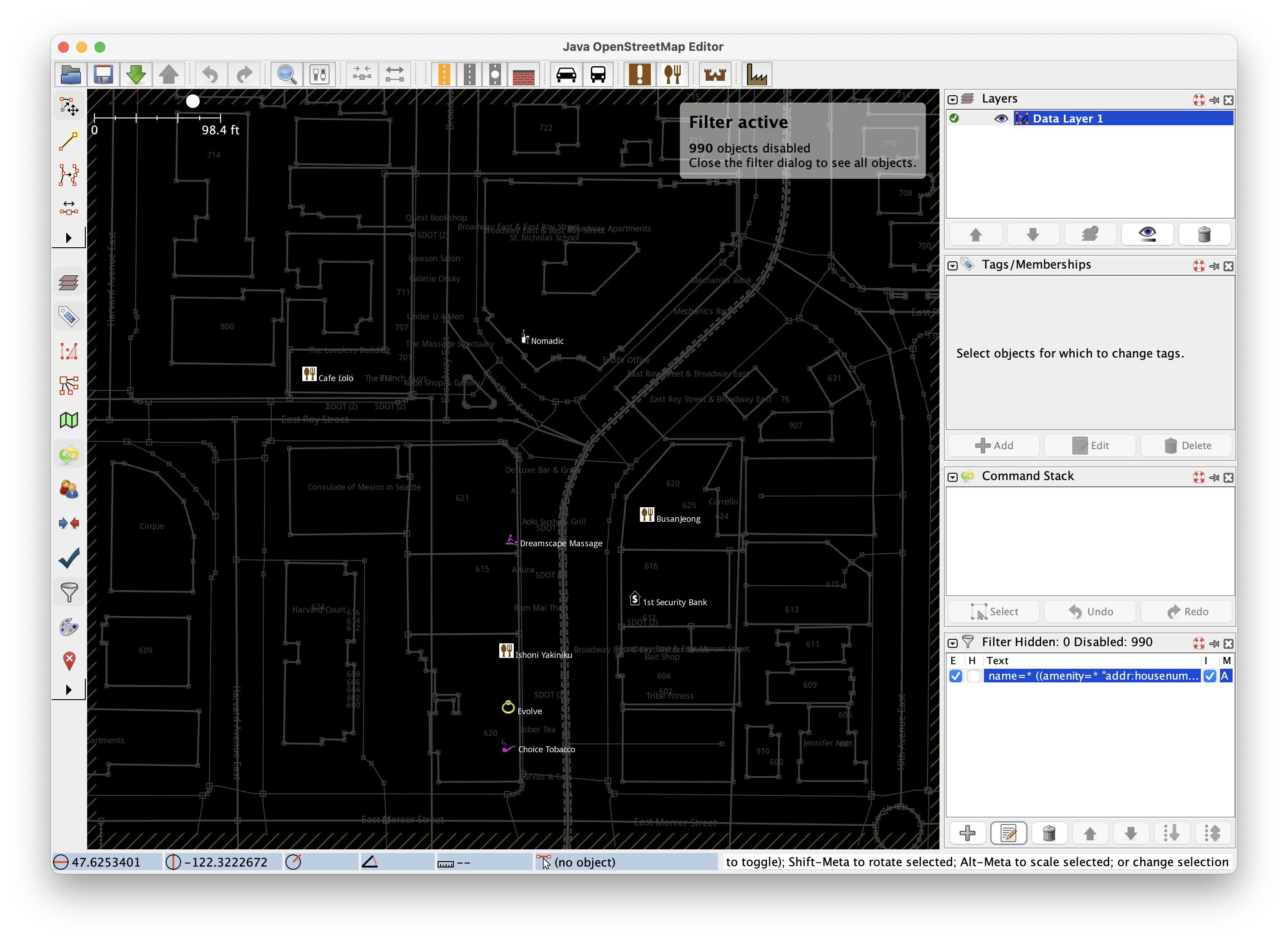 Figure: Filtered OSM data highlighting locations lacking website tags. Source: high5apps tutorial
Edits Rejected by Apple and Google Go Live Here in Hours
Among the 138 comments in the discussion, the most telling account came from a contributor trying to fix local cycling infrastructure. Frustrated that a newly completed bike lane in their neighborhood was missing from major digital maps, they physically rode the route to record GPX tracks. This hands-on survey was a necessary workaround for outdated corporate infrastructure: commercial mapping giants often take years to refresh satellite imagery in residential neighborhoods.
The contributor recounted how repeated correction requests submitted through Google Maps and Apple Maps were summarily rejected without explanation. Yet when they uploaded the GPX trace to OpenStreetMap, the new bike lane was merged, rendered, and synchronized across dozens of third-party apps within just a few hours. Proprietary platforms treat well-meaning users as unpaid, low-priority annotators, exhausting their goodwill behind sluggish, opaque moderation queues.
Submitting error reports to commercial mapping providers is notoriously akin to shouting into a void. Users have no visibility into whether a human or a malfunctioning classifier rejected their correction. In OSM’s decentralized architecture, a contributor simply tags the changeset source as survey before uploading. The edit propagates directly to the global master database and triggers tile re-rendering in near real time. This immediate, transparent loop grants ordinary people tangible digital stewardship over their physical surroundings.
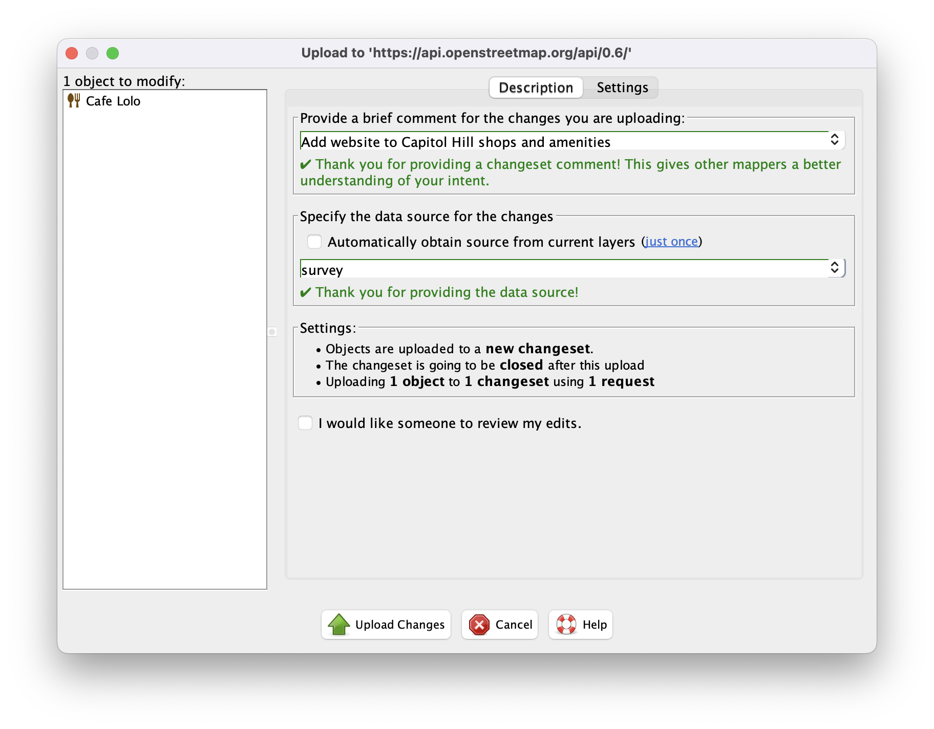 Figure: Uploading changeset panel with source tagged as survey. Source: high5apps tutorial
The Barrier of Entry: 365MB Desktop Software vs. Browser Editors
Aware that intimidating desktop interfaces can repel prospective contributors, experienced mappers quickly chimed in with practical onboarding advice. Their primary recommendation to newcomers was simple: don’t start with JOSM. Instead, beginners should head straight to the browser-based iD editor, which features an interactive tutorial and intuitive drag-and-drop vector drawing. Lowering this initial friction serves as the first line of defense against contributor churn.
Veteran mappers also highlighted collaborative entry points like MapRoulette and Humanitarian OpenStreetMap Team (HOT) tasks, which break complex city-scale modeling into bite-sized micro-tasks. While a 365 MB Java runtime and specialized plugins effectively screen out casual vandalism, that high technical barrier also locks out everyday residents who possess deep local knowledge.
The evolution toward lighter, web-first tooling aims to eliminate friction for anyone wanting to contribute common-sense observations. The iD editor empowers a user to pin a newly opened cafe in two minutes. Capturing this vast grassroots knowledge dividend is precisely what commercial platforms, bound by top-down economics, will never achieve.
How Endless Sidewalk Debates Drain Community Patience
In an autonomous open-source project without a full-time product manager to make executive calls, the tagging taxonomy relies entirely on community consensus and wiki documentation. A comment addressing mapping standards struck a nerve across the thread: even something as commonplace as a pedestrian sidewalk has evolved multiple competing, incompatible modeling paradigms within OSM.
One camp advocates tagging sidewalks as supplemental attributes directly on the roadway centerline (sidewalk=both). Another insists that sidewalks must be drawn as separate, parallel vector geometries (highway=footway). Without an authoritative central arbiter, resolving such foundational disagreements devolves into protracted debates across mailing lists and forum threads. Decentralization eliminates single points of failure, but shifts the staggering cognitive overhead of standardizing definitions onto individual volunteers.
This open governance prevents unilateral corporate de-platforming—no private company can erase a road that physically exists. But that freedom comes at a steep price, distributing governance friction directly onto the community. When the communicative exhaustion of arguing over tagging syntax eclipses the physical effort of mapping the street, the open-source collaboration engine begins to idle painfully.
The Right to Correct Is Rarer Than Geometric Data
The resonance of this beginner tutorial demonstrates that OpenStreetMap’s rarest asset is not vector geometry, but a transparent, accessible path to error correction with instant gratification. In a closed corporate ecosystem, a freshly paved neighborhood bike lane is merely marginal telemetry unworthy of reviewer attention. In an open-source commons, it is a living coordinate surveyed by local residents, ready to serve dozens of navigation apps in a matter of hours.
Behind that instant positive feedback lies the messy reality of a fractured tagging system. Every contributor must navigate the delicate tradeoff between structural purity and individual mapping freedom. Yet thousands of volunteers willingly fire up heavy Java clients to catalog web addresses for a million small shops, and pedal through traffic to capture GPS tracks when satellite feeds lag years behind. Rather than enduring a polished walled garden that silently discards their local knowledge, the world’s developer community continues to choose an imperfect, argumentative commons—where they hold the power to fix the map with their own hands.
References:
- high5apps Tutorial
- Hacker News Discussion (item?id=49674050)
- OpenStreetMap Wiki
- MapRoulette