Acrid Smoke 30 Miles Away and Red Hotspots on Satellite Maps
On a mid-August morning in 2026, residents in Cardiff opened their windows to a pungent smell of burning wood. Many initially assumed a neighbor was having a backyard barbecue or a nearby farmer was clearing stubble. The Met Office soon issued a notification: the smoke had drifted from a hillside wildfire 30 miles (48 km) away.
The blaze in Torfaen, a county in Wales with a population under 100,000, thrust the normally damp region into an unusual global spotlight in July 2026. Burning across more than 4,000 hectares—equivalent to roughly 5,600 standard football pitches—smoke billowed from vast swathes of the hillside.
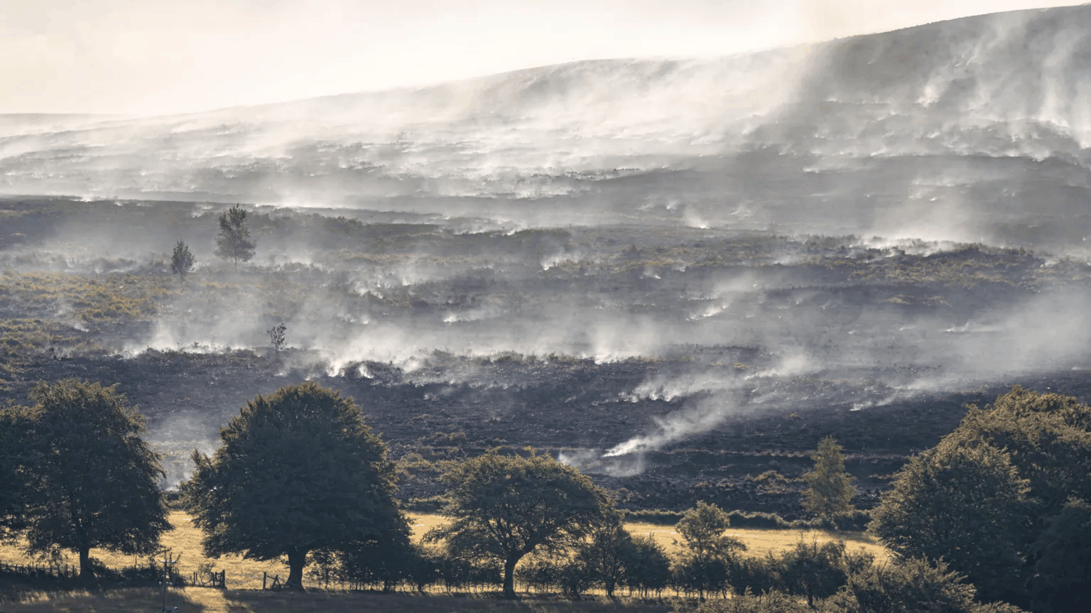 Figure: Wildfire smoke blowing over charred hillsides. Source: BBC / Stuart Baldwin SJB photography
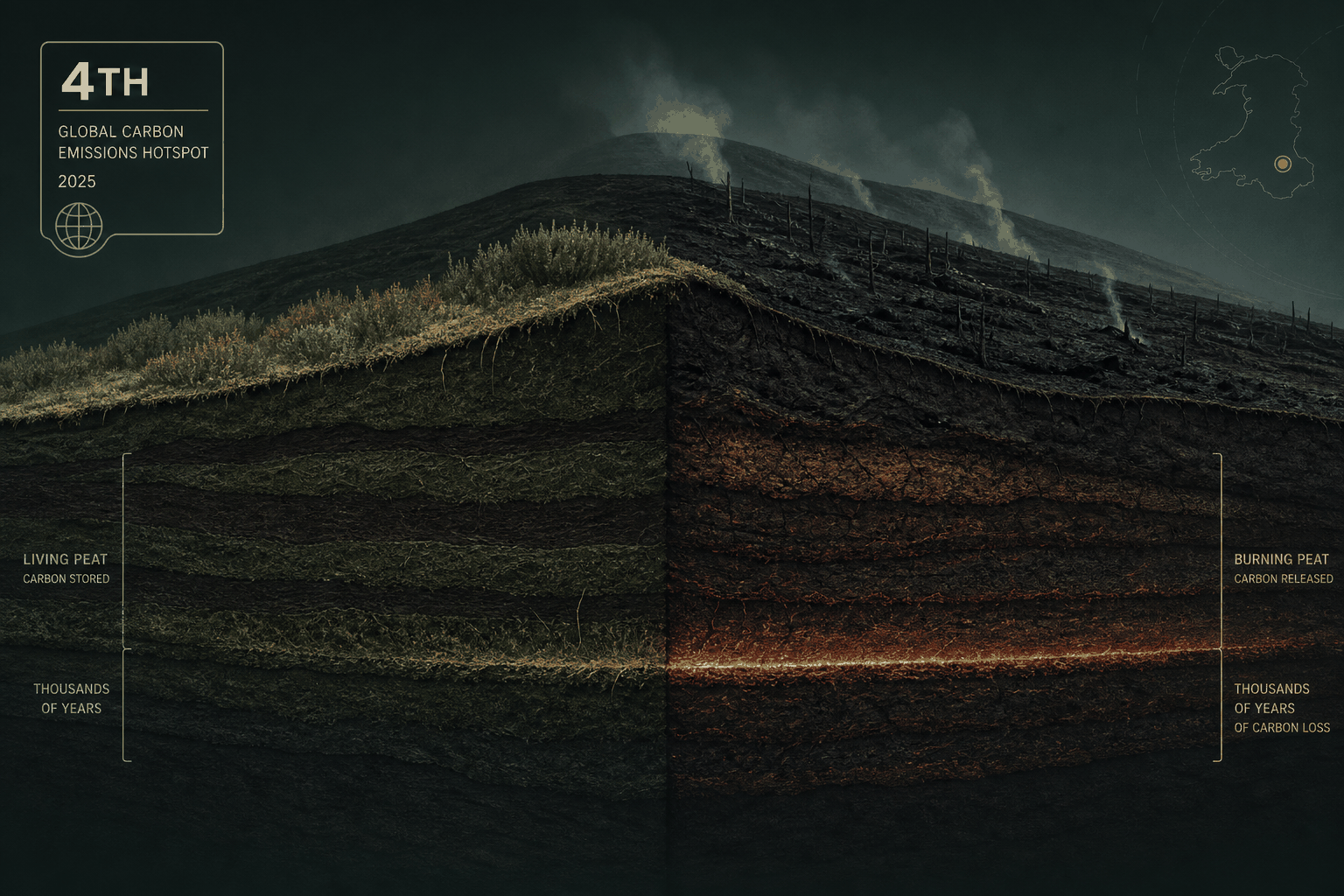
Data released by the Copernicus Atmosphere Monitoring Service (CAMS), the EU agency monitoring global air quality and carbon emissions, revealed that the Torfaen wildfire ranked fourth worldwide in carbon emissions intensity per square kilometer for July. The emission intensity was surpassed only by fires in Malanje (Angola), Ávila (Spain), and Annaba (Algeria). Monitoring scientists described Torfaen’s emission figures as “extremely unusual.”
The Ancient Underground “Carbon Bank” beneath the Hills
Why did a sparsely populated Welsh hill county produce carbon emissions per unit area exceeding many heavy industrial zones worldwide? The answer lies beneath the topsoil. The wildfire was not merely burning surface trees and bracken—it had ignited deep underground peat deposits.
Peatlands (accumulations of partially decayed vegetation formed over thousands of years in oxygen-poor wetlands) function as giant natural carbon sinks with exceptional carbon density. UK peatlands store over half of the nation’s total soil carbon—exceeding 3 billion tonnes. Carbon dioxide absorbed by plants over millennia of photosynthesis remains locked deep within these moist subterranean peat layers.
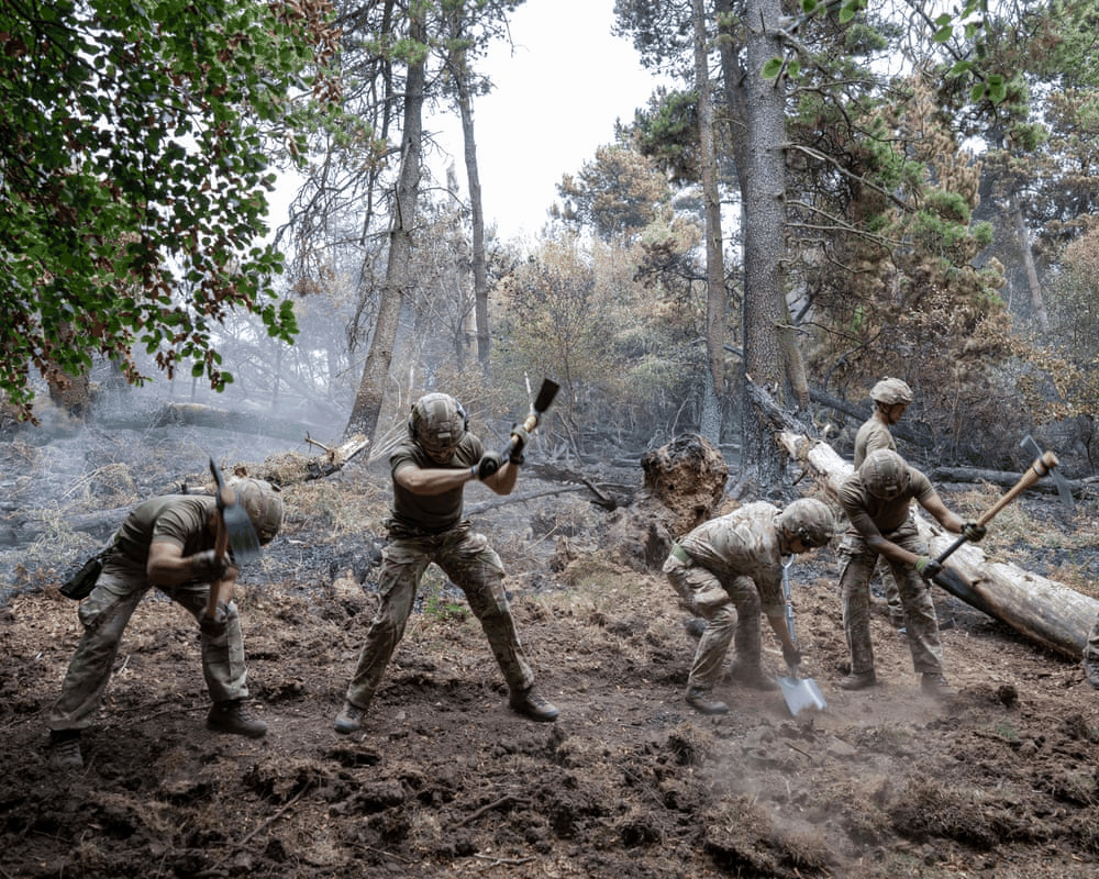 Figure: Military personnel cutting firebreaks to stop fire spread. Source: The Guardian / Adrian Sherratt
Peat formation is exceptionally slow, typically taking a thousand years to accumulate just one meter. Research published by the University of Cambridge in 2025 indicated that when extreme heatwaves and drought ignite dry peatlands, the carbon dioxide released from peat burning can double global fire carbon emissions.
Why Subterranean Fires Refuse to Cool Down at Night
Extinguishing the wildfire proved extraordinarily challenging. Jamie Windsor, station commander at the nearby Ebbw Vale fire station, remarked that in his 30-year firefighting career, he had never encountered a fire quite like this.
Conventional woodland fires spread primarily across the surface, naturally slowing at night as temperatures drop and humidity rises. Peat fires, however, manifest as deep smoldering combustion—flameless, slow-burning combustion taking place within oxygen-depleted, high-temperature peat layers beneath the surface.
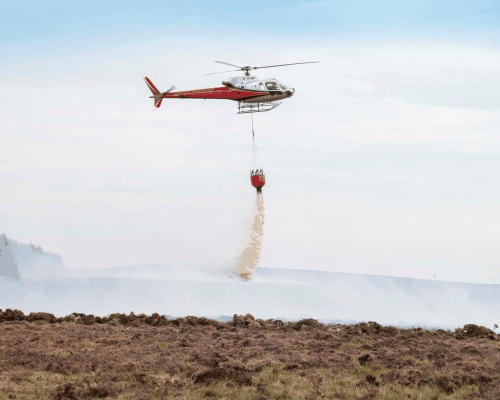 Figure: Helicopter dropping water repeatedly on reignited hotspots. Source: The Guardian / Adrian Sherratt
When firefighters poured massive volumes of water onto the surface, moisture struggled to penetrate the dense, meters-deep peat. Even after surface flames were doused, peat meters beneath the surface continued to smolder at hundreds of degrees Celsius. After creeping underground for days, flames would break out again dozens of meters away.
From Military Deployment to Respiratory Crisis: A Fire Burning Beneath Footsteps
Igniting in late July and raging into mid-August, the blaze placed tremendous strain on local public services. Emergency 999 calls to the South Wales Fire and Rescue Service surged from a typical 1,000 per week to over 7,000.
The UK Ministry of Defence deployed military troops to combat domestic wildfires for the first time since 2018. Soldiers from the Gurkha logistics regiment rushed to the scene, cutting trees and creating firebreaks across the rugged terrain.
The dense smoke created severe public health risks. Janet Jones, a local councilor in Blaenavon, Torfaen, expressed deep concern over air quality. The continuous high concentrations of airborne particulate matter posed a direct threat to elderly residents suffering from COPD (Chronic Obstructive Pulmonary Disease) and young children whose respiratory systems are still developing.
When Carbon-Storing Wetlands Reverse into Emission Hotspots
In the summer of 2026, drought was officially declared across all of Wales and nearly three-quarters of England. The Met Office warned that the summer was highly likely to set new record high temperatures for the UK.
Drought baked once-saturated peatlands dry. Under scorching temperatures, even a tiny spark can ignite carbon reservoirs buried for millennia.
The Torfaen wildfire serves as a stark warning: wildfires burn not only surface forests and structures, but can also release millennia of stored soil carbon back into the atmosphere in just a few weeks. When high temperatures and drought destroy the wetland environments protecting these carbon sinks, natural carbon banks swiftly transform into massive sources of carbon dioxide emissions.
Reference Links:
- BBC Report: Welsh Torfaen wildfire and carbon emission monitoring
- The Guardian Report: South Wales wildfire firefighting and military deployment